Bagden Quarry
Bagden quarry extends between NGR: SD 868 177 and SD 864 181 and lies at c. 350 m O.D. The quarry can be accessed from a public footpath running from Broadley Fold, which follows the route of a mineral tramway for the majority of its course, or from the Rossendale Way, which skirts the western side of the site. The quarry is in open access land
Historical Summary
Working life: Does not appear on the OS 1st edn map of 1844. Opened 1885 - 86 by Henry Heys Junior (Rothwell 2008). Shown as ‘Disused’ by 1894 (OS 2nd edn).
Quarry firms: Henry Heys & Co (Groundwork Rossendale n.d.).
Geology: Upper Haslingden Flags.
Methods: Hillside outcrop working.
Transport: Served by a narrow gauge tramway that ran to Broadley Stone Sidings (Roberts 1974, 22-3).
Products: Flagstones.
Events:
1844 The quarry is not plotted on the OS 6” 1st edn.
c. 1880’s Quarry known as ‘Home Rule Quarry’ and was owned by Henry Heys & Co. (Groundwork Rossendale n.d., 13).
1894 OS 6” 1st edn shown as ‘Disused’.
1902 The quarry was abandoned after the death of Heys (Rothwell 2008)
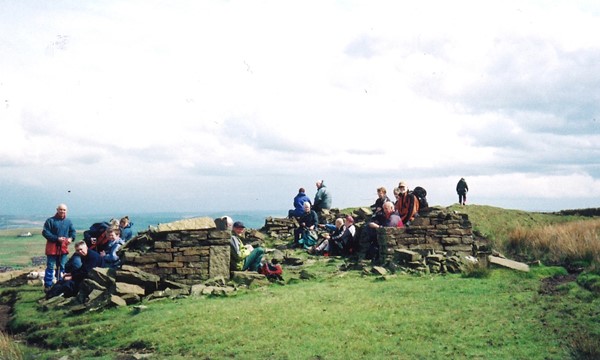
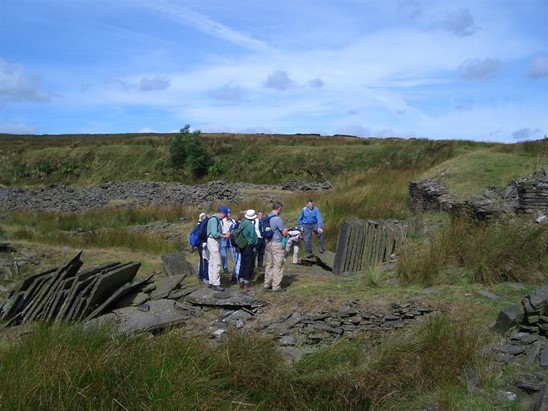
Summary of Surviving Remains: This moderately sized hillside quarry has a fairly extensive working face that is obscured by slumping and moorland vegetation. The spoil mounds associated with the quarry are located to the east of the working face and, although partially covered by moorland vegetation, are still well defined. These mounds range in height and consist morphologically of round and conical mounds, spoil fingers, a clearly distinguishable spoil fan at the northern end of the site, and an area of tipping, which extends down the side of the valley containing Fern Isle Brook. Moreover, the position of these mounds appear to correspond closely with the spoil areas which are plotted on the early edition OS maps. There are also a series of identifiable structures and features associated with the quarry. These include a number of quarrymen’s or blast shelters , a tramway , a probable winding house and a series of processing areas. The processing areas are particularly well defined and contain stacks of stone blocks and flagstones.
