Cragg quarry extends from SD 829 199 and SD 848 196, on the edge of the Cowpe valley. Cowpe Moss lies to the south and Mill Moor to the east. Historically, the bulk of the site lay within the Cowpe subdivision of the Cowpe, Lench, New Hall Hey and Hall Carr township (Bury parish), with its eastern tip extending into the Brandwood Lower End subdivision of the Spotland township (Rochdale parish). The area was formerly part of the medieval pasture land of Cowpe (Tupling 1927,20).
Historical Summary
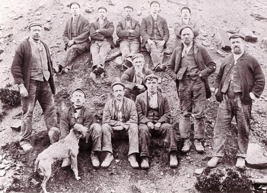
Working Life: Late eighteenth century origins; by 1844 it was a substantial quarry with its own rubbing mill at east end. Closed c1946 (Davies 1985-96). Quarry Firms: Lord and Taylor (rubbing mill, 1819/20), George Ashworth (rubbing mill, 1834), Butterworth and Brooks (1860s 1880s), Brooks and Brooks (Quarries) Ltd (1920s? see Roberts 1974, 16-17) and Caygill bros (1950s) (Davies 1985-96).
Geology: Upper Haslingden Flags
Methods: Hillside outcroppings and open pit working (Davies 1985-96) Transport: Stone was initially transported on cart to west and east (past rubbing mill and on to Rooley Moor Road and therefore possibly Rochdale), latterly on tramway to Whinberry Naze scrubbing mill and then down the incline plane to the mainline railway (Roberts 1974, 16-17). A winding engine operated between Cragg and Ding quarry to the south (Davies 1985-96).
Products: wide range
Events:
Circa 1810 Brandwood Survey states that Mill Moor belongs to the farms of Geo Ashworth J and H Ashworth and Mrs Ormerod, but does not appear to identify the rubbing mill.
1819/20 Spotland township survey names Lord and Taylor as owner/occupier of a ‘polishing mill and waterfall’. (Thought to be at SD GR 8480 1973.)
1834 Spotland Survey names George Ashworth as owner of a colliery on Mill Moor and of an empty polishing mill under the heading on Intake (which lies to the north of the Cragg rubbing mill but could be the same).
1848 OS 6” 1st edn (sheet 80) shows a long, linear quarry labeled ‘Cowpe Delf’ and ‘Sandstone (Flags)’, with ‘Rubbing Mill (stone)’ to east; also ‘Foe Edge Quarries’ to south west. The rubbing mill was composed of building reservoir, fed by extensive leats and a second reservoir to the south.
1865 ‘Scrubbing Mill’ advertised for sale in Bacup and Rossendale News (10 June) together with adjoining cottage occupied by William Fort. The mill included a new water-wheel, mortar stones and shafting/gearing (see Davies 1985 -96).
1866 John Maden was manager of the quarry of Butterworth and Brooks (Davies 1985-96).
1886 Owned by Butterworth and Brooks
1893 OS 25” map shows ‘Cragg Quarry’ at nearly its final extent joined up with the former Foe Edge quarries, together with a ‘Tramway’ running along the northern edge and continuing south to Ding Quarry. Of the rubbing mill, only the dam is shown and there is no label for it.
1911 OS 25” map again shows ‘Cragg Quarry’ and ‘Tramway’, together with several ‘cranes’.
Since 1893, the area of quarry was extended slightly at the north-west a east extremes and south of the ‘Cragg High Level Water Tank’. The rubbing mill reservoir is shown but not labelled.
1923 OS 6” geology map (sheet 72SW) shows quarry within the Lower Haslingden Flags and labelled ‘Flagstone and Sandy Shale’.
1930 OS map shows ‘Rubbing Mill reservoir (Bacup Corp W W)’.
1951 Rossendale Free Press (13 Oct) reported a 2 ton crane stolen from Cragg Quarry of Caygill Bros and Sons of Bacup (see Davies 1985-96)
Field Components Summary: Cragg quarry comprises a very large area of hillside outcropping and open pit quarrying. The main working face runs along the south side of the quarry with extensive spoil to the north incorporating complex multi-fingered spill heaps. The western half of the quarry broadens out into a complex mixture of outcroppings and open pits. The quarry may be approached by trackways from the west and east. These follow the tramway leading to Whinberry Naze and the stone slabbed trackway to the eastern rubbing mill. The continuation of the tramway beyond the quarry is a well-preserved linear earthwork. The quarry is extremely rich in associated quarry features. These include the remains of numerous structures and earthwork platforms (representing quarrymen’s shelters, storage buildings, and processing areas), heaps of part finished quarry products and stone offcuts, crane bases, and extensive tramway remains including a broad turning area and a short incline towards the quarry face.
