Pinner quarry extends between SD 806 252 and SD 811 256, on the western side of the Limey Water valley, immediately west of Crawshaw Booth. Historically, the site lay within the Crawshaw Booth subdivision of the Higher Booths township (Whalley parish). The area was formally part of the medieval vaccary of Crawshaw Booth (Tupling 1927, 20). The quarry is on Lancashire’s SMR (Sites and Monuments Registar) number 7965.
Historical Summary:
Working Life: opened 1841 (Davies 1985-96). Disused by 1923 (OS 1925 6” geology map).
Quarry Firms: Butterworth and Brooks, later Brooks and Brooks (1878), Richard Wyld (pre 1892), Ormerod Ashworth (1892). One inspectors return shows only five men employed ( Davies 1985-96).
Geology: Lower Haslingden Flags ( Davies 1985 -96).
Methods: hillside outcropping and mining. Stone sought was the band nearest the floor, shaley rock above was removed to access and loosen it (Davies 1985 – 96).
Products: building stone, flags, setts, engine beds ( Davies 1985-96).
Events:
1841 Quarry opened (Davies 1985-96). 1844 – 7 OS edn (sheet 72) shows ‘Sandstone Quarry (Flags)’. It shows the same length of quarry as on the 1911 map, the road from quarry to Crawshaw Booth and the terrace off Pinner Lane.
1878 Marshall Jones Brooks was granted a license to store gunpowder in a newly erected building.
1892 Ormerod Ashworth took over the quarry from R Wyld ( Davies 1985-96)
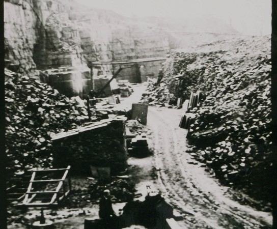
1909 OS 25” map shows ‘Quarry’ at full extent. A ‘Crane’ is also labeled.
1923 OS 6” geology map (sheet 72NW) shows quarry in Lower Haslingden Flags. Two ‘Mine mouth, abandoned’ symbols are shown against the quarry Wright et al (1927) indicate that Sand Rock Mine (coal seam) outcrops in Pinner Clough to the south of the quarry.
1928 OS map shows ‘Old Quarry’ with the same extent as on the 1909 map.
1981 The Quarry is being used as an unofficial dump ( Davies 1985-96).
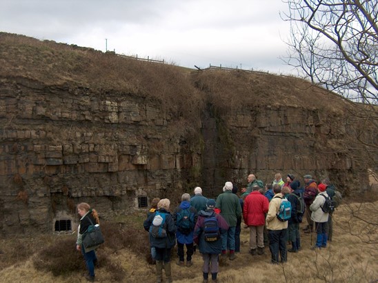
Field Components Summary: Overview The bulk of the site is a single hillside quarry with the working face to the north, and spoil heaps tipped behind. Over the southern half of the working face are a series of eight mine entrances, which open into a series of extensive underground galleries. The spoil heaps include a few remains of multi-fingered spoil tipping, especially in the south-east, but the form of the majority of the spoil is undistinguished. The quarry may be approached by three trackways, at the north-east, east and south. The southern track is the former ‘Pinner Lane’, which is now blocked at its east end.